How the Morning Commute Quietly Determines Which Blocks Hold Their Value
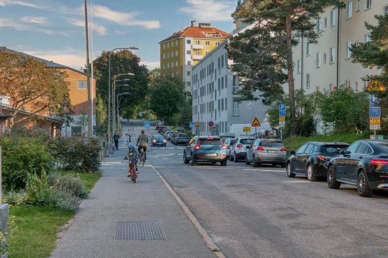
Every weekday morning, something invisible happens to your neighborhood. Drivers searching for shortcuts activate their navigation apps, delivery trucks begin their rounds, and the collective pressure of a metropolitan area's daily movement redistributes itself across residential streets. The results accumulate quietly over years — worn curb edges, altered pedestrian habits, shifting property values — and by the time most homebuyers notice, the pattern has long been established.
Understanding how commute infrastructure shapes residential character is not a peripheral concern for serious buyers. It is, in many respects, the foundation beneath every other quality a neighborhood possesses.
The Cut-Through Problem Nobody Talks About
When traffic engineers design arterial roads, they intend to concentrate vehicle flow along specific corridors. In practice, residential streets adjacent to those corridors absorb significant overflow — particularly during peak commute hours when drivers seek any path of least resistance.
A street that sits two blocks from a congested arterial can experience a dramatic increase in through-traffic between 7:00 and 9:00 a.m. and again between 4:30 and 6:30 p.m. Navigation platforms like Waze and Google Maps have accelerated this phenomenon considerably. Studies published by transportation researchers at UCLA found that app-directed routing increased cut-through traffic in some Los Angeles neighborhoods by as much as 64 percent over a five-year period.
For homeowners, the consequences extend well beyond inconvenience. Elevated traffic volumes correlate with reduced pedestrian activity, which in turn diminishes the informal social monitoring that criminologists call "eyes on the street." Fewer neighbors walking dogs, fewer children playing outside, fewer spontaneous front-porch conversations — each reduction chips away at the community cohesion that supports long-term property values.
Before making an offer on any home, it is worth visiting the street during peak commute hours on a weekday. The difference between a quiet cul-de-sac and a de facto cut-through can be striking, and it is a distinction that no listing photograph will ever reveal.
Delivery and Service Routes: The New Variable
The growth of e-commerce has introduced a category of traffic that did not exist at meaningful scale a decade ago. Residential neighborhoods now routinely absorb multiple daily passes from delivery vehicles — UPS, FedEx, Amazon, USPS, and an expanding roster of same-day couriers — in addition to traditional service traffic from landscaping crews, HVAC technicians, and home health aides.
This shift carries real implications for block-level livability. Streets with high concentrations of package deliveries experience more double-parking, more frequent large-vehicle maneuvers, and greater wear on road surfaces and curb cuts. In tightly spaced neighborhoods, a single delivery truck blocking the roadway can create backup congestion that ripples through adjacent streets.
The demographic composition of a block also influences delivery density. Neighborhoods with higher concentrations of dual-income households, remote workers, or older residents who rely on delivery services tend to attract heavier service-vehicle traffic. This is not inherently negative — it reflects economic vitality — but it is a variable worth factoring into quality-of-life assessments.
Municipal data on service vehicle routing is not always publicly accessible, but local traffic studies, which many cities publish through their public works departments, can provide useful baseline information. Buyers willing to request this data before closing gain a meaningful informational advantage.
How Commute Infrastructure Affects Community Cohesion
There is a body of urban planning research suggesting that streets with higher traffic speeds and volumes function as social barriers. Residents on either side of a busy street interact less frequently, form fewer cross-street relationships, and report lower levels of neighborhood satisfaction than residents on comparable low-traffic blocks.
Donald Appleyard's landmark study of San Francisco residential streets, conducted in the 1970s and replicated in various forms since, found that residents of heavily trafficked streets had an average of 0.9 acquaintances on their block, compared to 3.0 on moderately trafficked streets and 9.3 on light-traffic streets. The street itself functioned as a social membrane — permeable or impermeable depending on traffic intensity.
This dynamic has direct consequences for property values. Neighborhoods with strong social ties tend to maintain their physical condition more effectively, organize around shared concerns more readily, and attract buyers who prioritize community — buyers who, statistically, remain in place longer and invest more consistently in their properties.
A block where neighbors know one another is a block where someone notices the broken fence, reports the suspicious vehicle, and shows up with a casserole after a family emergency. These interactions do not appear in market data, but their cumulative effect on neighborhood stability is substantial.
Reading Traffic Patterns as a Valuation Signal
Sophisticated buyers and their agents have begun incorporating traffic analysis into due diligence in ways that parallel the traditional review of school ratings and walkability scores. Several data tools now aggregate anonymized GPS movement data to produce street-level traffic assessments, and some real estate professionals have begun using these tools to evaluate blocks before recommending offers.
The core insight is directional: streets that serve primarily their own residents — where the vast majority of vehicles have a destination on that block — tend to outperform cut-throughs over time on measures of value appreciation, resident tenure, and physical upkeep. Streets that function as connective tissue for broader commute patterns absorb costs that their residents did not choose and cannot easily escape.
This does not mean that proximity to arterials is always a liability. Blocks that benefit from arterial access without absorbing its traffic — typically those set back by a buffer street or screened by commercial development — can offer the best of both conditions: accessibility without intrusion.
What to Look for Before You Commit
For buyers evaluating a specific property, a few practical steps can illuminate the commute dynamics of any given block:
Visit at multiple times. A single weekend afternoon visit tells you almost nothing about weekday traffic behavior. Return during the morning and evening commute windows, and if possible, during a school drop-off period if there are schools nearby.
Check municipal traffic counts. Many cities and counties publish annual average daily traffic (AADT) data by road segment. These figures provide a quantitative baseline that is far more reliable than informal observation alone.
Assess pedestrian infrastructure. Sidewalk condition, crosswalk placement, and the presence of traffic-calming measures such as speed tables or chicanes signal how seriously a municipality has invested in managing vehicle-pedestrian conflict on a given street.
Talk to residents. Neighbors are typically candid about traffic frustrations, and a five-minute conversation at the curb can surface information that months of data review would never produce.
At 119 Woods Drive, we believe that the most durable home purchases are built on a complete picture of the property and its surroundings — not simply the features visible through a front door. The daily commute that flows past a home is as much a part of that picture as the square footage within it. Buyers who learn to read circulation patterns before they sign a contract position themselves to make decisions that hold their value long after the moving trucks have come and gone.